
National Capital Commission
National Capital Core Area Plan
Client: National Capital Commission (NCC), Ottawa
Credits: Project Leader: Andrew Sacret, Senior Urban Designer and Project Manager: Patrick Bunting, Senior Graphic Designer: Jessie Maisonneuve, Graphic Designer: Kim Leung RGD, Urban Planners: Jack Graham, Homa Jalili Safarian, GIS Spatial Analysts: Kara Tippett
Summary
The National Capital Commission’s (NCC) National Capital Core Area Plan is a two-volume masterplan supported by a multi-year communications and design initiative. A new visual identity, layout framework and design system were developed to communicate a long-term vision for the future of the interconnected downtowns of Ottawa and Gatineau.

Context
As the guiding framework for the development, stewardship and experience of federal lands within the Capital Core, the plan positions Canada’s Capital as a vibrant, accessible, sustainable and internationally significant urban environment. It emphasizes high-quality public spaces, cultural and natural heritage, universal accessibility and seamless connectivity between national institutions and everyday civic life.
The audience is broad and diverse, including the general public, federal government departments, urban planners, developers, Indigenous communities and other stakeholders. To address the needs of these varied audiences, the project required a comprehensive design system spanning print publications, accessible PDFs, digital engagement tools, illustrations, maps, iconography, urban planning diagrams, photography, videography, posters and consultation materials.
The objective was to create a cohesive, engaging and accessible visual language that translated complex planning information into content that could be understood and navigated by technical and non-technical audiences alike.
Design process
The development of the 2025 Core Area Plan followed a structured, iterative and design-led process grounded in research, analysis, consultation and multidisciplinary collaboration. Building upon the previous 2005 plan, the team addressed emerging priorities including population growth, climate resilience, housing affordability, reconciliation, evolving mobility patterns and changing workplace dynamics, while preserving the symbolic and functional importance of Canada’s Capital.
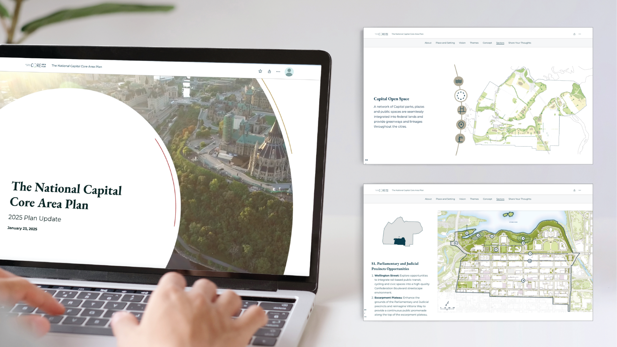
The visual identity and communication strategy evolved alongside an extensive public engagement program, ensuring that information was not only communicated effectively but also supported meaningful public participation. GIS-based StoryMaps were used as a key engagement platform, incorporating custom maps, illustrations, iconography, photography and multimedia content to create an accessible and interactive consultation experience. Visual materials were continuously tested and refined through stakeholder and community feedback, allowing the team to validate clarity, usability, accessibility and visual hierarchy throughout the design process. This iterative approach ensured that complex planning concepts were communicated in ways that resonated with a wide range of audiences.
The project required close collaboration among graphic designers, urban planners, urban designers, geomatics specialists, videographers, photographers and communications professionals. Through an integrated workflow, the team developed and refined illustration styles, map treatments, diagram concepts, layouts, accessibility practices and content systems. These collaborative processes enabled multiple contributors to work simultaneously while maintaining consistency across all deliverables and ensuring accessibility requirements were embedded from the outset.
Solution
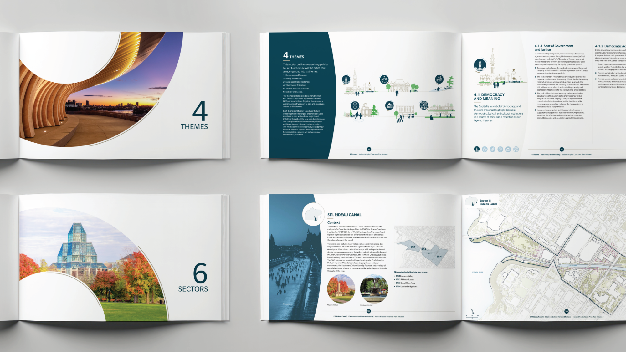
The final Core Area Plan presents a clear and structured framework that progresses from vision and guiding principles to thematic directions and spatial strategies. A comprehensive visual system was developed to support this hierarchy, translating complex planning concepts into accessible and engaging communication tools.
To achieve the project goals, the team created a multi-platform engagement campaign featuring a hybrid identity that combined elements of the NCC corporate brand with a distinct visual language unique to the Core Area Plan. This included original illustrations, theme-based iconography, posters, map styling and curated photography from the NCC image library. Together, these elements reinforced the plan’s narrative while creating a consistent experience across print, digital and public-facing communications.
The implementation of GIS-based StoryMaps provided innovative opportunities for public engagement. Interactive maps, multimedia content and accessible visual storytelling enabled users to explore planning concepts intuitively and at their own pace, transforming highly technical material into content that was engaging and understandable for the public.
The design system also supported decision-making by clearly communicating land use strategies, public realm improvements, ecological corridors, heritage assets, mobility networks and place-based opportunities. Information was presented at multiple scales, allowing stakeholders ranging from federal departments to residents to understand the plan’s vision and implications.
Accessibility was a central project requirement and was integrated throughout the design process. Final deliverables were produced in print and fully accessible PDF formats. Accessibility validation included InDesign and Acrobat workflows, PDF accessibility checkers and compliance reviews aligned with WCAG and PDF/UA standards. Key measures included proper heading structures, tagging hierarchy, reading order, internal navigation, colour contrast verification, proper PDF export settings and alternative text for images, maps and diagrams.
Which fundamentals of accessible design were considered?
Accessibility and inclusion were embedded throughout both the masterplan and the public engagement process. The project adopted a collaborative and people-centred approach that prioritized equitable access to information, participation and urban experiences.
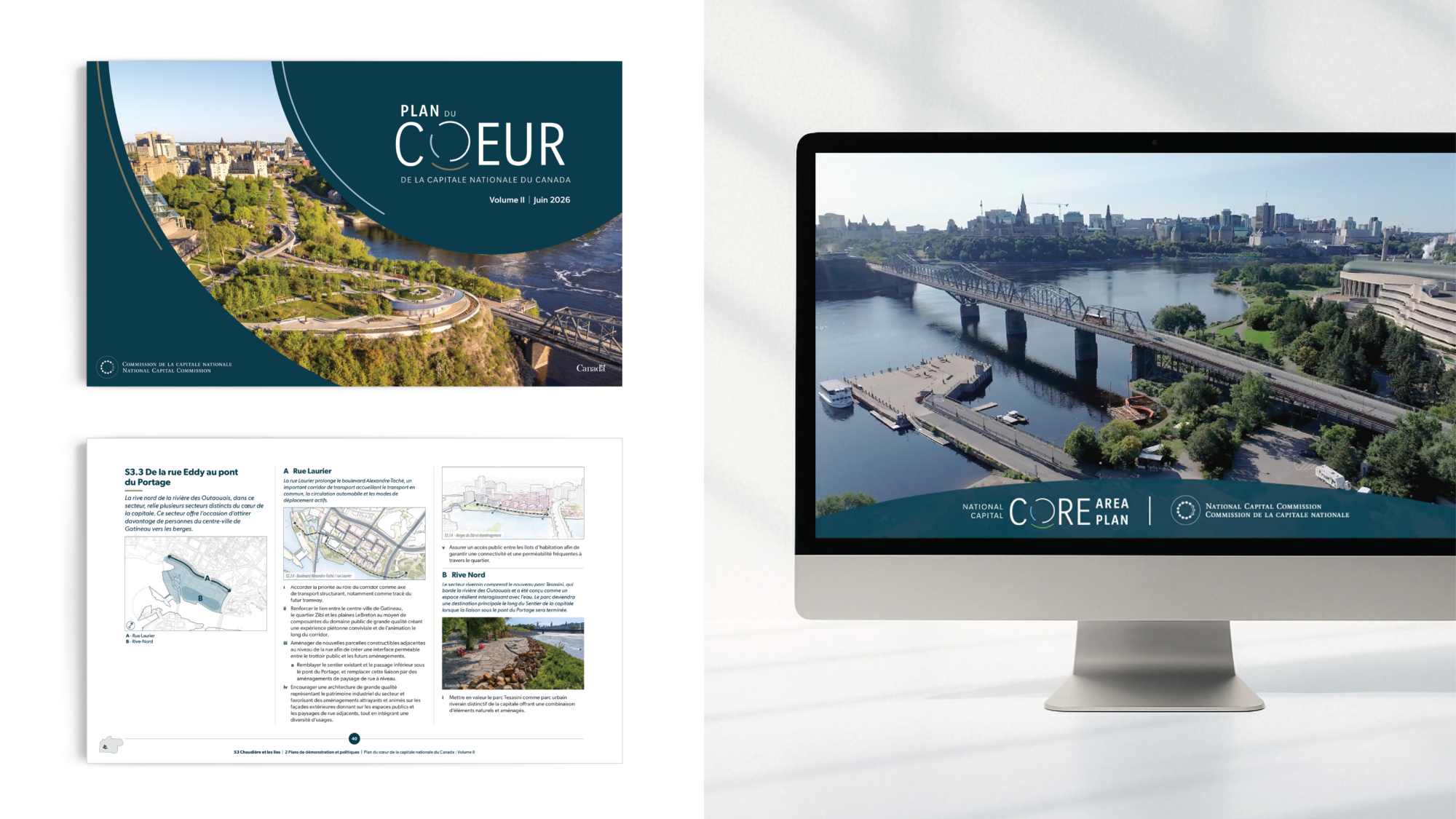
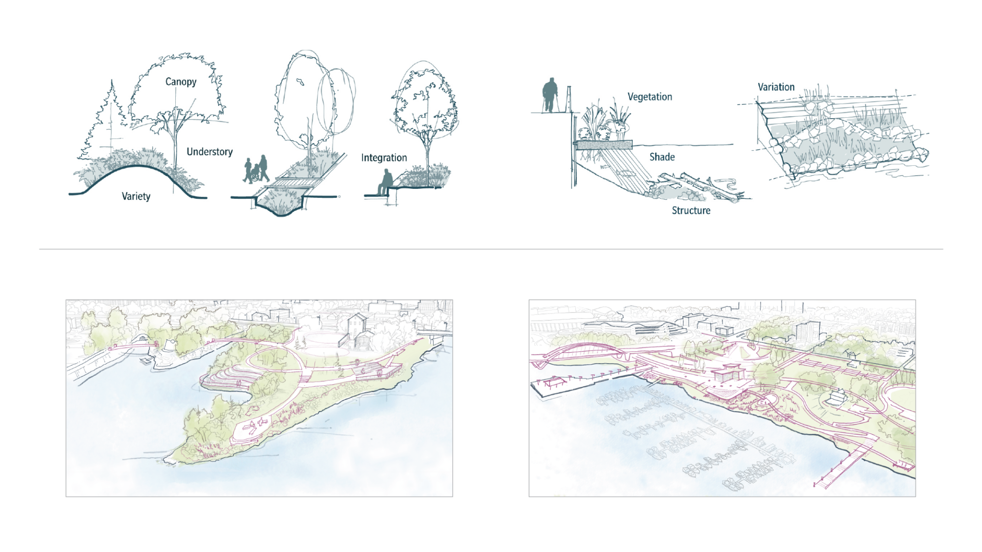
All consultation materials and final deliverables were developed in both official languages and made available through the NCC website in accessible formats. Universal accessibility principles were reflected within the planning content. This was implemented through masterplan diagrams, maps and site concepts that demonstrated barrier-free design strategies, including accessible circulation, clear sightlines, strategic lighting, active transportation connections, flood-resilient infrastructure and safe, welcoming public spaces.
Digital, web and print accessibility standards were consistently applied across all materials with WCAG and PDF/UA standards, within the concept, design and finalization phases. Implementation of accessibility within the concept and design phases was considered through accessible typography, sufficient colour contrast, logical information hierarchy, semantic document structure, alternative text, accessible navigation, such as bookmarks, verified reading flows with anchored image and diagrams and proper tagging of text and figures. Finalizing the materials for accessibility involved proper PDF export settings, such as tagged PDF, document titles, language selection, tab order, using PDF accessibility checkers and manual verification. Together, these measures ensured that information could be effectively accessed and understood by a broad range of users.
Does the project reflect the principles of diversity and inclusion? If so, explain.
Diversity, equity, inclusion and reconciliation were foundational considerations throughout the planning and design process.
The Core Area Plan reflects input from Indigenous communities, residents, businesses, institutions, government partners and community stakeholders. Its People First approach prioritizes barrier-free access, housing diversity, cultural representation, health, safety and equitable access to public spaces and services.
Located on the traditional and unceded territory of the Algonquin Nation, the plan supports ongoing collaboration with Algonquin communities in planning, design and stewardship activities. Indigenous perspectives and cultural heritage are recognized as integral components of the Capital’s identity and future development.
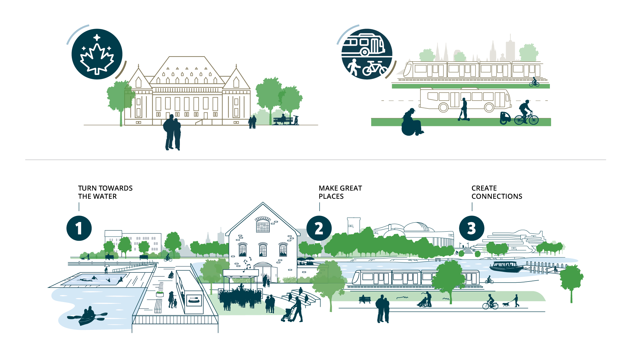
The visual communication materials further reinforced inclusion through symmetrical delivery in both of Canada’s official languages, accessible design practices and the use of representative visual expressions. Illustrations and diagrams utilized diverse silhouettes and figures reflecting a range of ages, abilities, backgrounds and lived experiences, ensuring that people could see themselves represented within the future vision of Canada’s Capital. Through these strategies, the project promotes a more resilient, sustainable, welcoming and inclusive National Capital Region for all.