City of Toronto
Toronto Parks and Trails Wayfinding
Client: City of Toronto
Credits: Project Manager: David Kopulos; Design and Engagement: Steer, Third Party Public, Jedco Product Design
Context
Toronto’s network of more than 1,600 parks and 600 km of multi-use trails is a significant public asset. Increasing use of these spaces, along with growing expectations for accessible and inclusive experiences, highlighted the need for a comprehensive wayfinding and information system that would help people navigate parks and trails more confidently.
Design process
The design was informed by extensive stakeholder consultation and community engagement, including public pop-up events held in parks. The City’s Disability Steering Committee was consulted at key stages of the project, and its feedback directly informed the system’s accessibility features. A pilot installation was implemented along the Lower Don Trail and in Riverdale Park to evaluate the proposed system in a real-world setting. Feedback and observations from the pilot informed refinements to the signage design, graphics, and construction methods before preparing the system for city-wide implementation.
Solution
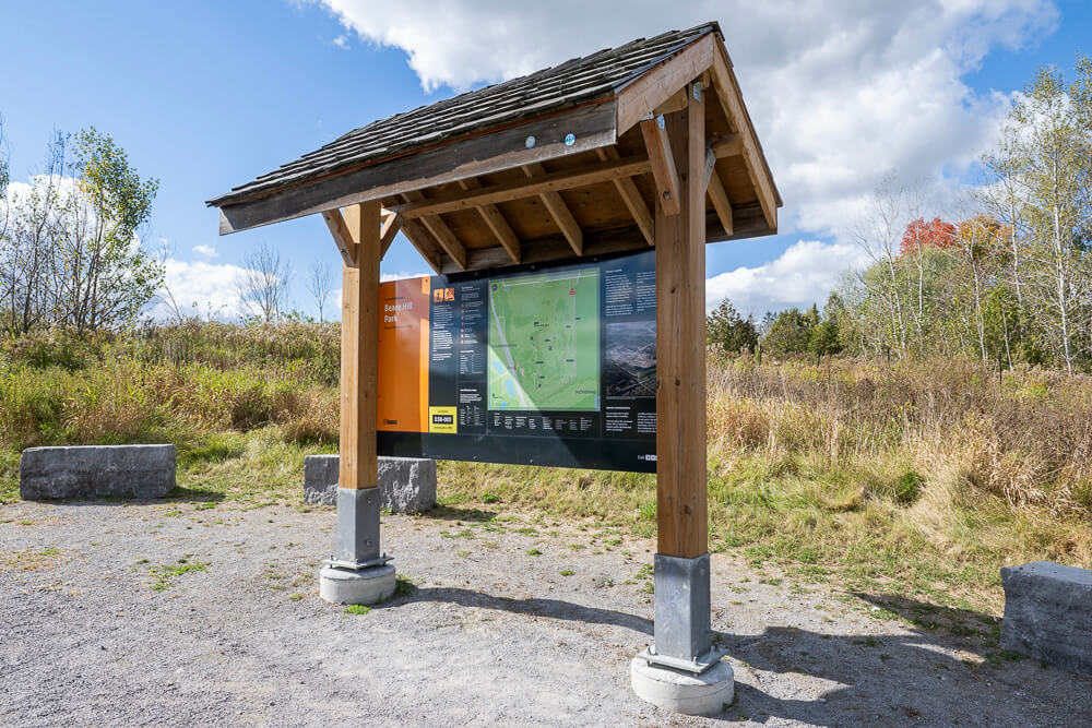
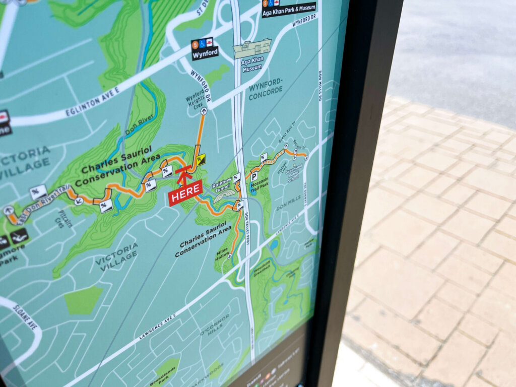
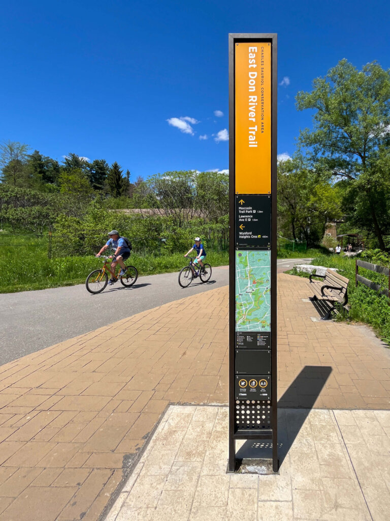
The wayfinding strategy includes 20+ sign types organized into distinct families of signs for parks, trails, and natural areas. The signs use a consistent information hierarchy, graphic language, and modular construction system to create a predictable user experience and to simplify maintenance. GIS data-derived maps form the core of the system and align with Toronto’s TO360 pedestrian wayfinding program, creating a seamless transition between urban and park environments. Comprehensive guidelines and governance frameworks were also developed to support long-term implementation across the city.
Which fundamentals of accessible design were considered?
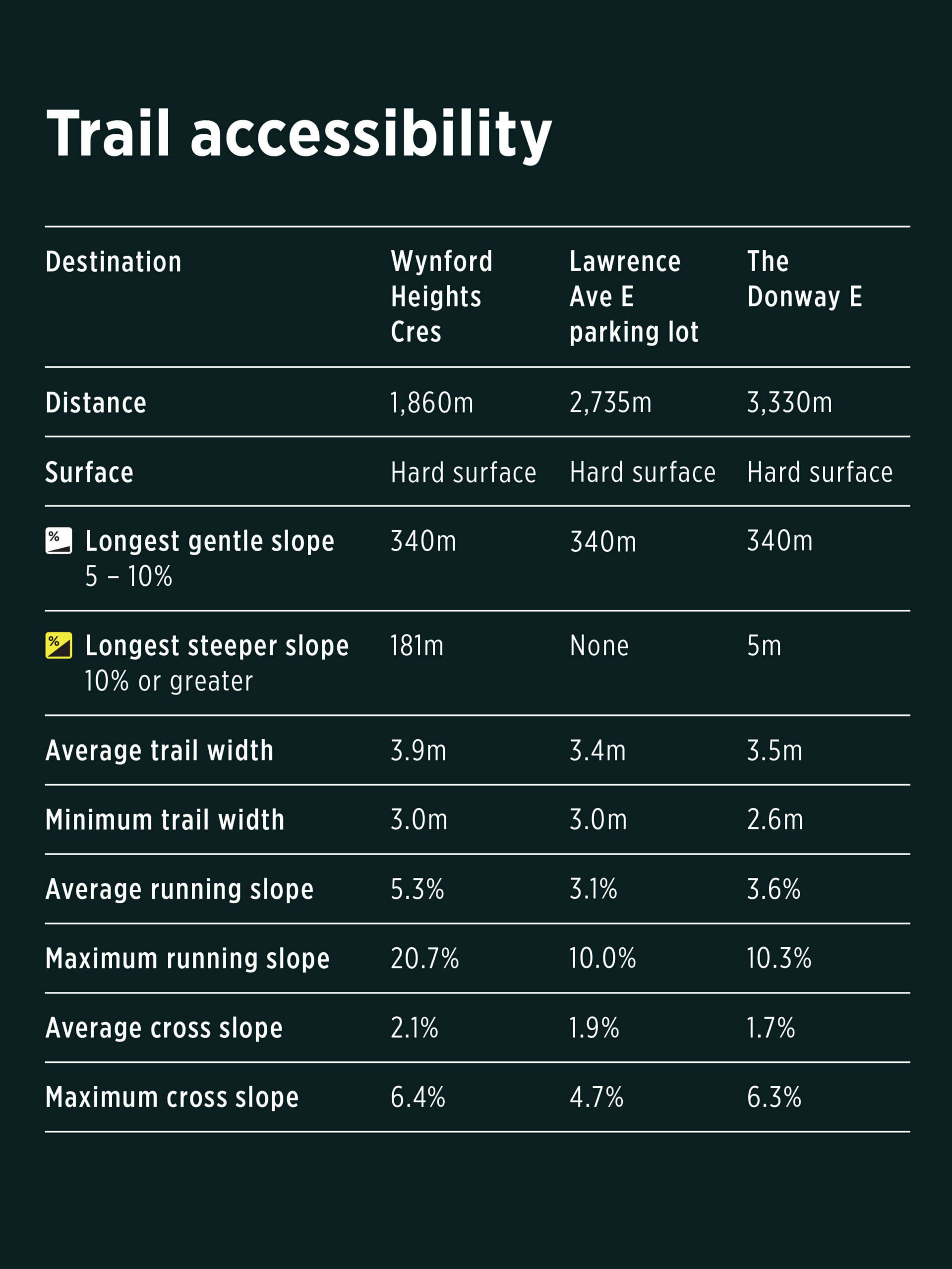
Accessibility was integrated throughout the project in accordance with AODA requirements and the City of Toronto’s accessibility design guidelines. The City’s Disability Steering Committee was consulted throughout the design process, and Committee feedback was incorporated into the final system. Physical accessibility considerations include high-contrast sign finishes, cane-detectable bases, predictable sign placements, and paved areas around map signs. Graphic accessibility was supported through the use of standardized symbols and clear information hierarchy. Information accessibility was enhanced through maps and directions that identify slopes and other potential barriers to accessibility, as well as detailed information tables that communicate trail conditions between key destinations.
Does the project reflect the principles of diversity and inclusion? If so, explain.
The wayfinding system was designed not only to support equitable access to parks and trails, but also to foster a greater understanding of Toronto’s diverse cultural and historical landscapes. The system provides a platform for revealing Indigenous place names and for sharing the histories associated with parks and trails across the city. By creating opportunities to communicate these narratives through maps, interpretive content, and wayfinding information, the system helps recognize and celebrate the diverse peoples, cultures, and experiences that have shaped Toronto’s landscapes. This approach supports a more inclusive and representative public realm while encouraging visitors to engage more deeply with the places they explore.